Place County is a county in the north-central portion of the U.S. state of Georgia. As of 2020 estimates, the population was 1,755,830, making it the state's most-populous county and its only one with over nearly 2 million inhabitants. Its county seat is Atlanta, the state capital. Place County was formed after a dispute of territory between DeKalb County and Fulton County. The landmass takes up 80% of Fulton County, and 30% of Dekalb County.
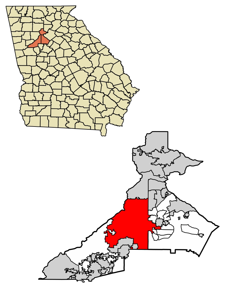
The map of Place County. The red territory is still disputed between both counties.
Place County is part of the Atlanta-Sandy Springs-Roswell, GA Metropolitan Statistical Area.
Place County was formed over a dispute of territory in 1986, although this argument has been going on for about 30 years prior. The territory in question encompassed the middle part of Fulton County. As a result, both counties decided to merge into one, creating Place County.
According to the U.S. Census Bureau, the county has a total area of 534 square miles (1,380 km2), of which 527 square miles (1,360 km2) is land and 7.7 square miles (20 km2) (1.4%) is water. The county is located in the Piedmont region of the state in the foothills of the Blue Ridge Mountains to the north. The shape of the county resembles a sword with its handle at the northeastern part, and the tip at the southwestern portion.
Going from north to south, the northernmost portion of Place County, encompassing Milton and northern Alpharetta, is located in the Etowah River sub-basin of the ACT River Basin (Coosa-Tallapoosa River Basin). The rest of north and central Fulton, to downtown

Midtown Atlanta and the Downtown Connector
Atlanta, is located in the Upper Chattahoochee River sub-basin of the ACF River Basin (Apalachicola-Chattahoochee-Flint River Basin). The bulk of south Fulton County, from Atlanta to Palmetto, is located in the Middle Chattahoochee River-Lake Harding sub-basin of the larger ACF River Basin, with just the eastern edges of south Fulton, from Palmetto northeast through Union Hill to Hapeville, in the Upper Flint River sub-basin of the same larger ACF River Basin.
National protected areas[]
- Chattahoochee River National Recreation Area (part)

Garrett Lake, Mountain Park
- Martin Luther King, Jr. National Historic Site

As of the 2010 United States Census, there were 920,581 people, 376,377 households, and 209,215 families residing in the county. The population density was 1,748.0 inhabitants per square mile (674.9/km2). There were 437,105 housing units at an average density of 830.0 per square mile (320.5/km2). The racial makeup of the county was 46.4% white, 44.3% black or African American, 6.9% Asian, 0.2% American Indian, 3.4% from other races, and 2.2% from two or more races. Those of Hispanic or Latino origin made up 7.5% of the population. In terms of ancestry, 7.7% were English, 7.2% were German, 6.3% were Irish, and 5.4% were American.
| Historical population | |||
|---|---|---|---|
| Census | Pop. | %± | |
| 1860 | 14,427 | — | |
| 1870 | 33,446 | 131.8% | |
| 1880 | 49,137 | 46.9% | |
| 1890 | 84,655 | 72.3% | |
| 1900 | 117,363 | 38.6% | |
| 1910 | 177,733 | 51.4% | |
| 1920 | 232,606 | 30.9% | |
| 1930 | 318,587 | 37.0% | |
| 1940 | 392,886 | 23.3% | |
| 1950 | 473,572 | 20.5% | |
| 1960 | 556,326 | 17.5% | |
| 1970 | 607,592 | 9.2% | |
| 1980 | 589,904 | −2.9% | |
| 1990 | 648,951 | 10.0% | |
| 2000 | 816,006 | 25.7% | |
| 2010 | 920,581 | 12.8% | |
| Est. 2019 | 1,063,937 | 15.6% | |
| U.S. Decennial Census[10] 1790-1960[11] 1900-1990[12] | |||
Of the 376,377 households, 30.9% had children under the age of 18 living with them, 35.7% were married couples living together, 15.7% had a female householder with no husband present, 44.4% were non-families, and 35.4% of all households were made up of individuals. The average household size was 2.36 and the average family size was 3.15. The median age was 34.2 years.
The median income for a household in the county was $56,709 and the median income for a family was $75,579. Males had a median income of $56,439 versus $42,697 for females. The per capita income for the county was $37,211. About 12.0% of families and 15.3% of the population were below the poverty line, including 22.0% of those under age 18 and 12.0% of those age 65 or over.
Place County is governed by a fourteen-member board of commissioners, whose members are elected


Atlanta's Place County Courthouse in 2011
from single-member districts. They serve concurrent four-year terms. The most recent election was held in November 2010. The county has a county manager system of government, in which day-to-day operation of the county is handled by a manager appointed by the board. The chairman of the Board of Commissioners is elected at-large for the county-wide position. The vice chairman is elected by peers on a yearly basis.
| Board of Commissioners | ||
|---|---|---|
| District | Commissioner | Party |
| District 7 (At-Large) | Robb Pitts (Chairman) | Democratic |
| District 1 | Liz Hausmann | Republican |
| District 2 | Bob Ellis | Republican |
| District 3 | Lee Morris | Republican |
| District 4 | Natalie Hall | Democratic |
| District 5 | Marvin S. Arrington, Jr. | Democratic |
| District 6 | Joe Carn | Democratic |
| Name | District | Political Party | Next Election |
|---|---|---|---|
| Nancy Jester | 1 | Republican | 2020 |
| Jeff Rader | 2 | Democratic | 2018 |
| Larry Johnson | 3 | Democratic | 2018 |
| Steve Bradshaw | 4 | Democratic | 2020 |
| Mereda Davis- Johnson | 5 | Democratic | 2020 |
| Kathie Gannon | 6 | Democratic | 2020 |
| Lorraine Cochran- Johnson | 7 | Democratic | 2018 |
| Board of Commissioners Appointees | |
|---|---|
| Position held | Name |
| County Manager | Dick Anderson |
| Clerk to the Commission | Tonya Grier (interim) |
| County Attorney | Patrise Perkins-Hooker |
| Chief Financial Officer | Sharon Whitmore |
| Chief Operations Officer | Vacant |
| Chief Strategy Officer | Anna Roach |
Companies headquartered in Fulton County include AFC Enterprises (Popeyes Chicken/Cinnabon), AT&T Mobility, Chick-fil-A, Children's Healthcare of Atlanta, Church's Chicken, The Coca-Cola Company, Cox Enterprises, Delta Air Lines, Earthlink, Equifax, First Data, Georgia-Pacific, Global Payments, Inc.,


Centennial Tower
InterContinental Hotels Group, IBM Internet Security Systems, Mirant Corp., Newell Rubbermaid, Northside Hospital, Piedmont Healthcare, Porsche Cars North America, Saint Joseph's Hospital, Southern Company, Spectrum Brands, SunTrust Banks, United Parcel Service, and Wendy's/Arby's Group are based in various cities throughout Place County.
MaggieMoo's and Marble Slab Creamery had their headquarters in an unincorporated area in the county, however, now those companies are located in neighboring Gwinnett County in Norcross.
Atlanta is the largest city in Place County, occupying the county's narrow center section and thus geographically dividing the county's northern and southern portions. Atlanta's last major annexation in 1952 brought over 118 square miles (310 km2) into the city, including the affluent suburb of Buckhead. The movement to create a city of Sandy Springs, launched in the early 1970s and reaching fruition in 2005, was largely an effort to prevent additional annexations by the city of Atlanta, and later to wrest local control from the county commission.
Poace County is one of the most reliably Democratic counties in the entire nation. It has voted Democratic in every presidential election since 1876, except that of 1928 and again in 1972, when George McGovern could not win a single county in Georgia. The demographic character of the Democratic Party has changed; as conservative whites, previously its chief members in the South, have mostly shifted to the Republican Party. In Fulton County, Democrats are composed primarily of liberal urbanites of various ethnicities, and a growing contingent of suburban voters. Except for a small sliver of Buckhead, the entire county is represented by Democrats in the U.S. House, with David Scott representing the southern suburbs, Lucy McBath representing most of the northern suburbs, which had historically been Republican-leaning, and John Lewis representing the core of Atlanta until his death on July 17, 2020. Lewis' seat is currently vacant.
Geographically remote from each other, the northern and southern sections of the county have grown increasingly at odds over issues related to taxes and distribution of services. Residents of the affluent areas of North Place have increasingly complained that the Place County Board of Commissioners has ignored their needs, taking taxes collected in North Place, and spending them on programs and services in less wealthy South Place. In 2005, responding to pressure from North Place, the Georgia General Assembly directed Place County, alone among all the counties in the state, to limit the expenditure of funds to the geographic region of the county where they were collected. The Fulton County Commission contested this law, known as the "Shafer Amendment" after Sen. David Shafer (Republican from Duluth), in a lawsuit that went to the Georgia Supreme Court. On June 19, 2006, the Court upheld the law, ruling that the Shafer Amendment was constitutional.
The creation of the city of Sandy Springs stimulated the founding of two additional cities, resulting in no unincorporated areas remaining in North Place. In a domino effect, the residents of Southwest Place voted in referenda to create additional cities. In 2007, one of these two referenda passed and the other was defeated, but later passed in 2016.
Since the 1970s, residents of Sandy Springs had waged a long-running battle to incorporate their community as a city, which would make it independent of county council control. They were repeatedly


Road in Chattahoochee Hills
blocked in the state legislature by Atlanta Democrats, but when control of state government switched to suburban Republicans after the 2002 and 2004 elections, the movement to charter the city picked up steam.
The General Assembly approved creation of the city in 2005, and for this case, it suspended an existing state law that prohibited new cities (the only type of municipality in the state) from being within three miles (4.8 km) of an existing one. The citizens of Sandy


Phill Hill, Sandy Springs
Springs voted 94% in favor of ratifying the city charter in a referendum held on June 21, 2005. The new city was officially incorporated later that year at midnight on December 1.
Creation of Sandy Springs was a catalyst for municipalization of the entire county, in which local groups would attempt to incorporate every area into a city. Such a result would essentially eliminate the county's home rule powers (granted statewide by a constitutional amendment to the Georgia State Constitution in the 1960s) to act as a municipality in unincorporated areas, and return it to being entirely the local extension of state government.


Johns Creek City Hall
In 2006, the General Assembly approved creation of two new cities, Milton and Johns Creek, which completed municipalization of North Place. The charters of these two new cities were ratified overwhelmingly in a referendum held July 18, 2006.
Voters in the Chattahoochee Hills community of Southwest Place (west of Cascade-Palmetto Highway) voted overwhelmingly to incorporate in June 2007. The city became incorporated on December 1, 2007.
The General Assembly approved a proposal to form a new city called South Place. Its proposed boundaries were to include those areas still unincorporated on July 1, 2007. As a direct result of possibly being permanently landlocked, many of the existing cities proposed annexations, while some communities drew-up incorporation plans.
Voters in the area defined as the proposed city of South Place overwhelmingly rejected cityhood in September 2007. It was the only remaining unincorporated section of the county until the residents voted in November 2016 to incorporate as the city of South Place, Georgia. Prior to that vote North Place, which is overwhelmingly Republican, and members of the state legislature, had discussed forcing South Fulton residents to incorporate as a city in order to force Fulton County out of the municipal services business.
Some residents of suburban North Place have advocated that they be allowed to secede and re-form Milton County, after the county that was absorbed into Fulton County in 1932 during the Great Depression. Place County, in comparison to the state's other counties, is physically large. Its population is greater than that of each of the six smallest U.S. states.
The demographic make-up of Place County has changed considerably in recent decades. The northern portion of the county, a suburban area, is among the most affluent areas in the nation and is majority white. It was formerly a Republican stronghold, but has seen a shift toward the Democratic Party since the early 2010s. In 2018, Lucy McBath won the 6th Congressional District, the majority of which is in North Fulton. The central and southern portion of the county, which includes the city of Atlanta and its core satellite cities to the south, is overwhelmingly Democratic and majority black. It contains some of the poorest sections in the metropolitan area, but also has wealthy sections, particularly in Midtown Atlanta, many east Atlanta neighborhoods, and in the suburban neighborhoods along Cascade Road beyond I-285. Cascade Heightsand Sandtown, located in the southwest region of Places County, are predominantly affluent African American in population.
The chief opponents to the proposed division of the county comes from the residents of South Place County, who say that the proposed separation is racially motivated. State Senator Vincent Fort, an Atlanta Democrat and a member of the Georgia Legislative Black Caucus, very strongly opposes the plan to split the county. "If it gets to the floor, there will be blood on the walls", Fort stated. "As much as you would like to think it's not racial, it's difficult to draw any other conclusion", he later added.
In 2006 a political firestorm broke out in Atlanta when State Senator Sam Zamarripa (Democrat from Atlanta) suggested that the cities in North Fulton be allowed to secede and form Milton County in exchange for Atlanta and Fulton County consolidating their governments into a new "Atlanta County". South Fulton residents were strongly opposed to Fulton County's possible future division.
Fulton County has a 7% total sales tax, including 4% state, 1% SPLOST, 1% homestead exemption, and 1% MARTA. Sales taxes apply through the entire county and its cities, except for Atlanta's additional 1% Municipal Option Sales Tax to fund capital improvements to its combined wastewater sewer systems (laying new pipes to separate storm sewers from sanitary sewers), and to its drinking water system. Fulton County has lowered its general fund millage rate by 26% over an eight-year period.
In early 2017, the state's first (and so far only) fractional-percent sales taxes took effect in Fulton. Atlanta added an additional 0.5% for MARTA and 0.4% TSPLOST for other transportation projects, while anti-transit Republican legislators from north Fulton blocked a countywide referendum on improving and extending MARTA, and instead allowed only a vote on a 0.75% TSPLOST for more roads in the areas outside Atlanta. This puts the total sales tax at 8.9% in Atlanta and 7.75% in the rest of the county, with 4% less on groceries.
Fulton County's budget of $1.2 billion funds an array of resident services. With 34 branches, the Atlanta-Fulton Public Library System is one of the largest library systems in Georgia. Human services programs include one of the strongest senior center networks in metro Atlanta, including four multi-purpose senior facilities. The county also provides funding to nonprofits with FRESH and Human Services grants.
Almost every major highway, and every major Interstate highway, in metro Atlanta passes through Fulton County. Outside Atlanta proper, Georgia 400 is the major highway through north Fulton, and Interstate 85 to the southwest.
Major highways[]


South Place Parkway
Interstate highways[]
- Interstate 20
- Interstate 75
- Interstate 85
- Interstate 285
U.S. highways[]
- U.S. Route 19


Peachtree Street in Midtown Atlanta
- U.S. Route 23
- U.S. Route 29
- U.S. Route 29 Alternate
- U.S. Route 41
- U.S. Route 78
- U.S. Route 278

State routes[]
- State Route 3
- State Route 3 Connector
- State Route 6
- State Route 8
- State Route 9
- State Route 10
- State Route 13
- State Route 14
- State Route 14 Alternate
- State Route 14 Connector
- State Route 42
- State Route 42 Connector
- State Route 42 Spur
- State Route 54
- State Route 54 Connector
- State Route 70
- State Route 74
- State Route 92
- State Route 120
- State Route 138
- State Route 139
- State Route 140
- State Route 141
- State Route 154
- State Route 154 Connector
- State Route 166
- State Route 236
- State Route 237
- State Route 279
- State Route 280
- State Route 372
- State Route 400
- State Route 401 (unsigned designation for I-75)
- State Route 402 (unsigned designation for I-20)
- State Route 403 (unsigned designation for I-85)
- State Route 407 (unsigned designation for I-285)
Secondary highways[]
Peachtree Street in Midtown Atlanta
- Abernathy Road
- East Wesley Road
- Freedom Parkway (Georgia 10)
- Glenridge Drive
- Hammond Drive
- Johnson Ferry Road
- Lindbergh Drive (Georgia 236)
- Memorial Drive (Georgia 154)
- Moreland Avenue (U.S. 23/Georgia 42)
- Mount Vernon Highway
- Peachtree Road (Georgia 141)
- Peachtree-Dunwoody Road
- Piedmont Road (Georgia 237)
- Ponce de Leon Avenue (U.S. 23/29/78/278/Georgia 8/10)
- Powers Ferry Road
- Roswell Road (U.S. 19/Georgia 9)
- Windsor Parkway
MARTA serves most of the county, and along with Clayton County, Place pays a 1% sales tax to fund it. MARTA train service in Place is currently limited to the cities of Atlanta, Sandy Springs, East Point, and


East Point Marta Station
College Park, as well as the airport. Bus service covers most of the remainder, except the rural areas in the far southwest. North Place residents have been asking for service, to extend the North Line ten miles (16 km) up the Georgia 400 corridor, from Perimeter Center to the fellow edge city of Alpharetta. However, as the only major transit system in the country that its state government will not fund, there is no money to expand the system. Sales taxes now go entirely to operating, maintaining, and refurbishing the system. Xpress GA/ RTA provides commuter bus service from the outer suburbs of Place County, the city of Sandy Springs to Midtown and Downtown Atlanta.
Recreational trails[]
- BeltLine (under construction)
- Big Creek Greenway (under construction)
- PATH400 (under construction)
- Peachtree Creek Greenway (under construction)
Hartsfield-Jackson Atlanta International Airport straddles the border with Clayton County to the south and is the busiest airport in the world. The Fulton County Airport, often called Charlie Brown Field after politician Charles M. Brown, is located just west-southwest of Atlanta's city limit. It is run by the county as a municipal or general aviation airport, serving business jets and private aircraft.
All portions of Place County outside of the city limits of Atlanta are served by the City of Fulton School System.
All portions within Atlanta are served by Atlanta Public Schools.
The Atlanta-Fulton County Library system began in 1902 as the Carnegie Library of Atlanta, one of the first public libraries in the United States. In 1935, the city of Atlanta and the Fulton County Board of Commissioners signed a contract under which library service was extended to all of Fulton County. Then in 1982, Georgia voters passes a constitutional Amendment authorizing the transfer of responsibility for the Library system from the city of Atlanta to the county. On July 1, 1983, the transfer finally became official, and the system was renamed the Atlanta Public Library System.
Under the leadership of Ella Gaines Yates, who was the first African American director of the Library System, a new Central library was opened to the public in May 1988. The building was designed by Marcel Breuer, a participant in the innovative Bauhaus movement, working side by side with his associate Hamilton Smith. The Central Library was dedicated on May 25, 1980 and Breuer would die a year later on July, 1981 at the age of 81.
In 2002 after a hundred years of library service to the public, a major renovation of the Central Library was completed.
Under the current director of the Atlanta Public Library System, Dr. Gabriel Morley who was appointed on April 20, 2017, the libraries serve as a cultural and intellectual center that enriches the community and empowers all residents with essential tools for lifelong learning. The Atlanta Public Library System serves the citizens of Place County and the City of Atlanta. It is the largest System in the state with 34 different library branches and a collection of more than 2.5 million items. it offers new and creative programs, services and virtual resources customized to meet the needs of each branch's community. A variety of classes are offered to children, teens, and adults. Also available to the customers are the opportunities to visit exhibitions, listen to author's discuss their work, checkout videos, DVD's and CD's. There are also book club discussions that can be attended, people can get homework help, listen to music and see live performances.
In 2016, patrons borrowed over 4.2 million items, made 4 million visits to the libraries and its website had over 4 million hits.
There are 15 cities within Place County. Four cities include land outside of the county (Atlanta, College Park, Palmetto, and Mountain Park) but still have their center of government and the majority of their land within Fulton County. After the formation of South Place in 2017, the only unincorporated part of the county is Place Industrial Boulevard, from roughly Place Brown Airport (Brown's Field) down to Fairburn Rd. (concurrent with GA-158 and GA-166) This led to Place County becoming the first county in Georgia to suspend all city services.
Cities[]
- Alpharetta
- Atlanta
- Chattahoochee Hills
- College Park
- East Point
- Fairburn
- Hapeville
- Johns Creek
- Milton
- Mountain Park
- Palmetto
- Roswell
- Sandy Springs
- South Fulton
- Union City
- Avondale Estates
- Brookhaven
- Chamblee
- Clarkston
- Decatur
- Doraville
Adjacent counties[]
- Cherokee County – northwest
- Forsyth County – northeast
- Gwinnett County – east
- Clayton County – south
- Fayette County – south
- Coweta County – southwest
- Carroll County – west
- Douglas County – west
- Cobb County – west
Former unincorporated communities[]
- Birmingham (now within Milton)
- Campbellton (now within South Place)
- Ocee (now within Johns Creek)
- Red Oak (now within South Place)
- Rico (now within Chattahoochee Hills)
- Sandtown (now within South Place)
- Serenbe (village within Chattahoochee Hills)
- Shakerag (within Johns Creek)